Mt. Adams Round-The-Mountain (Truly)

CELEBRATE THE OUTDOORS
40 years outdoors experience, extensive info on Mt. Rainier’s Wonderland Trail, original music, equipment reviews, off trail videos, other peaks in Mt. Rainier NP
just a ridiculous flower showWhat better way to really do a conditions report on the Wonderland Trail than actually hiking the better portion of it? My June 9/10 clockwise hike from Longmire to Sunrise can be summed up thusly: for snow and general conditions, it's like August. For trail maintenance, it's like June (iow, nada). This is probably the only time I would consider hiking the Wonderland a "wilderness experience" due to the fact that one of the major access points is not open until June 19 (Mowich Lake road) and both crossings over the Mowich Rivers are out. Throw in blowdown and a few eradicated sections of trail, schwacking and log crossing the Mowich rivers, and negotiating some snow at Skyscraper Pass, and the traditional backpackers that come to hike the Wonderland from all over might be discouraged at the moment. Every park I transited above 5000 feet was bursting at the seams with a riot of flowers. Unfortunately, those hiking the trail during the more "normal" season starting in July will probably not enjoy the spectacle I witnessed, but at least the trail crews should have fixed the problems I've mentioned. One thing's for sure, Wonderland hikers coming this summer will enjoy a snow free trail.
This link to a trip report I posted on NWHikers provides some details about the trip, including the difficulties enocountered, along with myriad photos. The photo album can also be viewed on the Willis Wall facebook page. The following video will give the reader a good idea of the August like conditions I experienced and perhaps an incentive for people with a date for the trail.
Eroding ash plain, north side of Mt. St. Helens, Loowit Trail orbit
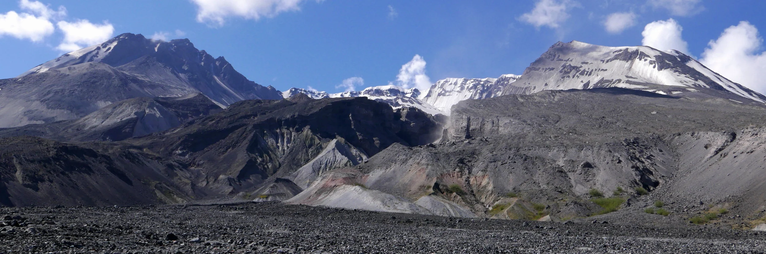
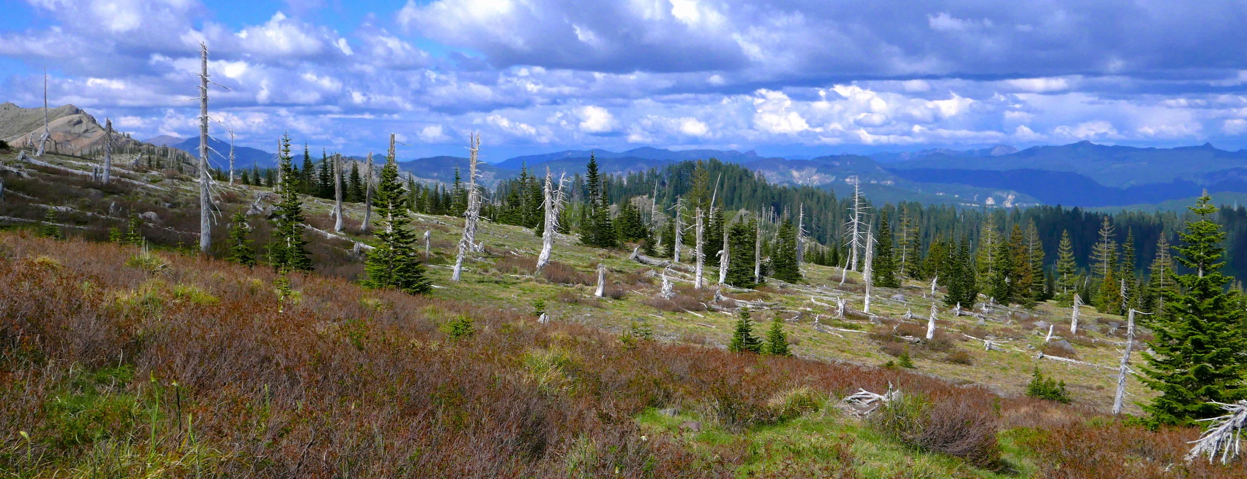
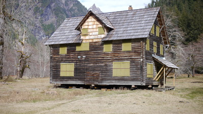
Volcanoes dominate some skylines in the Pacific Northwest. Just witness how many photos are published of the Seattle area with Mt. Rainier in the background. We climb them, ski them, and hike around them. Which brings me to Mt. St. Helens, the show stopper of 1980 when the summit collapsed and produced the Earth's largest recorded landslide in an eruption that displaced 3.7 billion cubic yards of material from the mountain. Lahars, mud flows, ash deposits and blown over denuded trees made the landscape surreal. Now, 35 years later, my daughter and I decided to hike the Loowit Trail which circumnavigates the mountain and takes the hiker through the impact area in a transit that sees the lingering effects and amazing recovery of the ecosystems.We took two days to make the 32 mile trip, sleeping in on the first day and driving the 3.5 hour trip to our hop on point at Climber's Bivouac on the south side of the mountain. A 2 mile trail took us to the intersection with the Loowit Trail for us to start our Counter Clockwise transit. Sticking to our plan, we hiked approximately 12 miles the first day and bivied on the Plains of Abraham, an area just before entering the restricted zone, where camping is not allowed. (Full set of photos here)
How does one adequately describe this hike in a few paragraphs? The south side sees trail crossing boulder fields with adequately spaced wooden posts placed to guide the hiker as there is no real trail in these sections. Gradually we entered the impact zone where trees were mown over like toothpicks, all pointing away from the blast direction, but some half covered in deposits, some still standing, and some being surrounded by meadow and flowers and new trees. The impact zone itself can be characterized by ravines, gullies and an occasional chasm. The deposit of this vast amount of ejected material is easily cut by creeks and rivers, with near vertical walls to contend with. At the South Fork Toutle River crossing, there are ropes to assist the hiker in ascending and descending into the ravine because of the loose and steep material one must try to find purchase on. And don't expect any bridges either, making for a few feet wet crossings. Did I mention the heat? Miles of hiking with no shade and the sun heating up the lava rocks all around you. Better carry enough water too, as sources are scarce. But I don't mean to complain about the various challenges on this hike, as the geologic interest, vastness of the area, expansive views and hidden surprises (like our visit from a Northern Pygmy Owl during a rest break back in old growth) more than compensate for the conditions. Prepare for a little grit in your socks and be amazed at the power of nature, both in its destructive capabilities and in its amazing ability to recover and rebuild.
Transiting the south side of the Loowit trail, Mt. Adams in the distance
Ghosts begin to appear as we enter the transition to the impact zone on Mt. St. Helens' east side
Ghosts slipping away, blast zone Mt. St. Helens
Mt. St. Helens dome in 2004
descending to the South Fork Toutle River, Mt. St. Helens
Mt. St. Helens dome in 2007
Glacier lillies already at Indian HenrysOne to two months ahead. Pretty much sums it up when it comes to this year's snow levels in most parts of the Cascades. Usually I take a trip up to Panhandle Gap in June or July and report on the snow conditions, but this year it hardly seems necessary. Yesterday my daughter and I took a jaunt to Indian Henry's Hunting Ground on the Wonderland trail, nestled in a picturesque area at 5400 feet. There were no snow patches until above 5000 feet and what remains is patchy and sparse, with depths of no more than a foot. If current warm weather trends continue, this snow will be gone in a matter of days. I dare say one could hike the Wonderland beginning in June and experience the same kind of conditions normally seen in late July (in fact this is what I did, see report here). Problem areas may occur due to the lack of park personnel this early, as in facilities are not open and trail maintenance has not begun. Expect blow downs and possible river/creek crossings where the bridges have been washed out, although these will be high priority as soon as the crews get out. There is always a problematic area on the Wonderland below Martha Falls in the Stevens Canyon area that sees erosion and washout every year. Additionally, the steep areas on the trail between the North Puyallup camp and Klapatche park may be difficult to navigate if snow is still present. However, this can be bypassed if necessary by taking the St Andrews trail out of Klapatche Park and circumventing via the West Side Road to the North Puyallup camp. And of course the park service always issues navigation warnings concerning snow over Panhandle Gap. In a nutshell, anyone hiking the trail during the "usual" season starting in late June should enjoy snow free steps.
sparse snow at Indian Henrys and melting fast
Continuing this year's trend of hikes with conditions seemingly months ahead of the weather schedule, I left my skis at home to hike up to Camp Muir, the popular base camp for climbers at Mt. Rainier National Park. I wanted to test my legs on a good outing as I just underwent minor surgery and will not be able to hike, climb, or bike for weeks. I also wanted to make use of one of the new mounts I got for my GoPro, clipping it to my pack strap. With the camera set to take one photo per second, I departed Paradise (5400') and did a single push to Camp Muir (10,100') in 2 hours 55 minutes, only stopping once to change out the GoPro battery. Some other new equipment used on this journey: a Panasonic Lumix LX100 camera and a 3 liter Geigerrig pressurized bladder. The weather was sublime and I was comfortable, sometimes even sweltering, in just a base layer and a windshirt. Very much like a hike in June or July. After arriving at Muir I lounged, ate lunch and took photos, chatting it up with a HS friend of my daughter's who just happened to be there with her dad. On the way down the conditions were too sloppy for a good plunge step and I found myself sinking up to my knees on occasions higher up, but this goes with the territory. My footwear consisted of Inov8 running shoes (GoreTex lined) and some gaiters. One might get the impression from the time lapse that this is a benign hike, but the weather can turn nasty higher on this mountain and people have perished on the Muir snow field in years past. Hikers, exercise caution and good sense, especially when it comes to sun protection! But if you have ever wondered what this hike is all about, take the 6 minute journey.
Summerland is an extremely popular hike in Mt. Rainier National Park during....the summer. It offers spectacular views and is under 10 miles for the roundtrip. Winter is a whole different animal; usually. The Pacific Northwest is "enjoying" very mild weather and low snow accumulations. I wanted to see firshand what was up so a trip to Summerland was in order. However, access is limited as HW 410 is closed from the Crystal Mountain turnoff, meaning that access to this area of the park is usually limited to snomobiles or people on snowshoes or skins willing to trek 9 miles into the park just to access the trailhead. For me it was a matter of mounting my mountain bike and enjoying snow free roads until less than half a mile from the trailhead. The following shots are frame grabs from video I took a week earlier when I checked out the road with my buddy.
HW 410 gate closure
junction for White River park entrance